Derelict road forming part of Taff Trail
Introduction
The photograph on this page of Derelict road forming part of Taff Trail by Nigel Davies as part of the Geograph project.
The Geograph project started in 2005 with the aim of publishing, organising and preserving representative images for every square kilometre of Great Britain, Ireland and the Isle of Man.

There are currently over 7.5m images from over 14,400 individuals and you can help contribute to the project by visiting https://www.geograph.org.uk
Derelict road forming part of Taff Trail
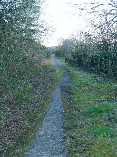
Image: © Nigel Davies Taken: 5 Apr 2008
The moss and grass have almost completely reclaimed the tarmac. Only a well travelled strip and the occasional manhole cover make this feel like part of a road at all. The map shows that this is now part of Cycle Route 8 and the Taff Trail. By consulting older maps, contributor Colin Bell confirms it was the original path of the 470 (now renumbered A4054) which runs around the hill in a slightly wider and lower arc out of shot to the right. The new A470 is the dual carriageway, yet another road running parallel.
Images are licensed for reuse under creativecommons.org/licenses/by-sa/2.0
Image Location


Leaflet Map data © OpenStreetMap
Latitude
51.640909
Longitude
-3.325692