Macleod Street, Nelson, Lancashire
Introduction
The photograph on this page of Macleod Street, Nelson, Lancashire by Dr Neil Clifton as part of the Geograph project.
The Geograph project started in 2005 with the aim of publishing, organising and preserving representative images for every square kilometre of Great Britain, Ireland and the Isle of Man.

There are currently over 7.5m images from over 14,400 individuals and you can help contribute to the project by visiting https://www.geograph.org.uk
Macleod Street, Nelson, Lancashire
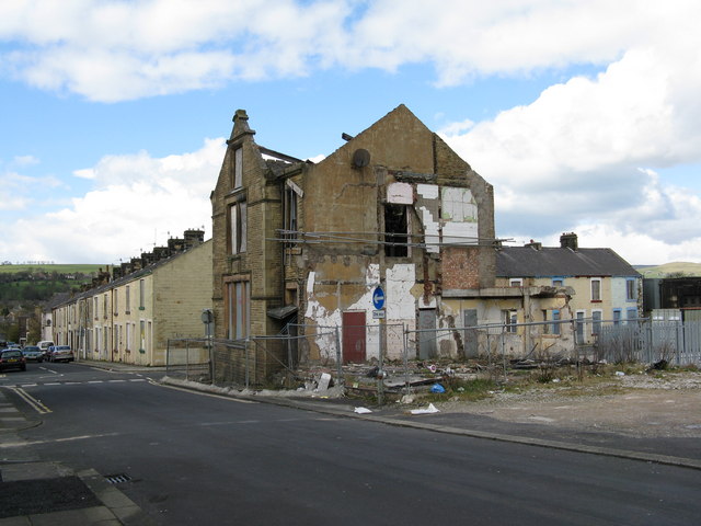
Image: © Dr Neil Clifton Taken: 5 Apr 2008
Things do not look good for Macleod Street. The ruin was formerly the presbytery attached to St. Joseph's RC Church, which latterly was a concrete building which was on the space in right foreground of the picture. This has replaced an earlier building destroyed by fire in the 1960s.
Images are licensed for reuse under creativecommons.org/licenses/by-sa/2.0
Image Location
Latitude
53.835623
Longitude
-2.219993