Benchmark on building on NW side of Main Street
Introduction
The photograph on this page of Benchmark on building on NW side of Main Street by Roger Templeman as part of the Geograph project.
The Geograph project started in 2005 with the aim of publishing, organising and preserving representative images for every square kilometre of Great Britain, Ireland and the Isle of Man.

There are currently over 7.5m images from over 14,400 individuals and you can help contribute to the project by visiting https://www.geograph.org.uk
Benchmark on building on NW side of Main Street
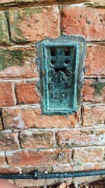
Image: © Roger Templeman Taken: 28 Jun 2023
Ordnance Survey flush bracket (serial number 1237) levelled at 157.820m above Newlyn Datum in 1955 and verified in 1968. Originally levelled at 517.810 feet above Newlyn Datum during the Castor to Waltham on the Wolds 2GL Survey (1921)
Images are licensed for reuse under creativecommons.org/licenses/by-sa/2.0
Image Location
Latitude
52.796404
Longitude
-0.696011