Mashfords Boatyard, Cremyll
Introduction
The photograph on this page of Mashfords Boatyard, Cremyll by Alan Murray-Rust as part of the Geograph project.
The Geograph project started in 2005 with the aim of publishing, organising and preserving representative images for every square kilometre of Great Britain, Ireland and the Isle of Man.

There are currently over 7.5m images from over 14,400 individuals and you can help contribute to the project by visiting https://www.geograph.org.uk
Mashfords Boatyard, Cremyll
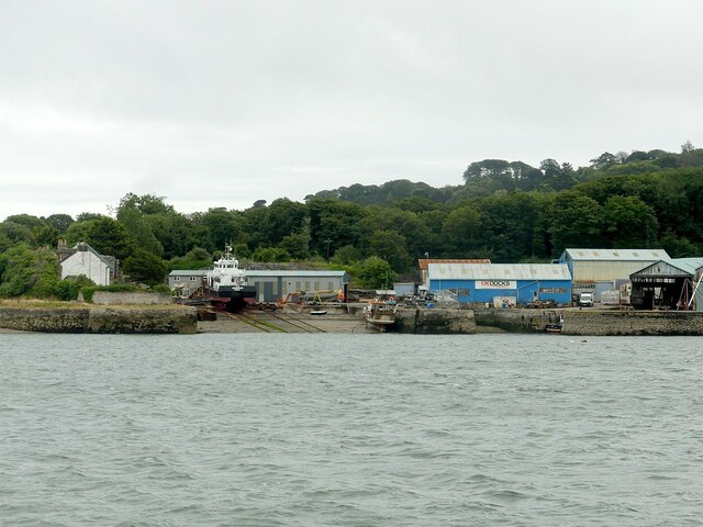
Image: © Alan Murray-Rust Taken: 30 Jun 2023
Now operated by UK Docks, but retaining the Mashfords identity. Founded in the 18th century with the stone jetties and one boatshed (not in view) dating from this period and Listed Grade II.
Images are licensed for reuse under creativecommons.org/licenses/by-sa/2.0
Image Location
Latitude
50.360817
Longitude
-4.177705