Bradwell War Memorial and St Barnabas' Church
Introduction
The photograph on this page of Bradwell War Memorial and St Barnabas' Church by David Dixon as part of the Geograph project.
The Geograph project started in 2005 with the aim of publishing, organising and preserving representative images for every square kilometre of Great Britain, Ireland and the Isle of Man.

There are currently over 7.5m images from over 14,400 individuals and you can help contribute to the project by visiting https://www.geograph.org.uk
Bradwell War Memorial and St Barnabas' Church
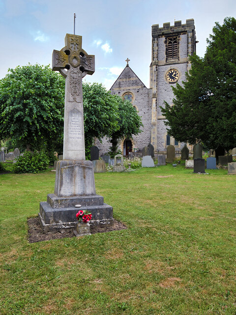
Image: © David Dixon Taken: 1 Jul 2023
The memorial stands in front of St Barnabas Church, facing the main road. It is in the form of a two-stepped base surmounted by a plinth and wheel cross https://www.roll-of-honour.com/Derbyshire/BradwellStBarnabas.html (more information and names of the fallen). The church was built 1867-8 with the tower added 1888-91. It is a Grade II listed building (List Entry Number:1087832 https://historicengland.org.uk/listing/the-list/list-entry/1087832?section=official-list-entry Historic England).
Images are licensed for reuse under creativecommons.org/licenses/by-sa/2.0
Image Location
Latitude
53.326354
Longitude
-1.73902