Tintinhull houses [1]
Introduction
The photograph on this page of Tintinhull houses [1] by Michael Dibb as part of the Geograph project.
The Geograph project started in 2005 with the aim of publishing, organising and preserving representative images for every square kilometre of Great Britain, Ireland and the Isle of Man.

There are currently over 7.5m images from over 14,400 individuals and you can help contribute to the project by visiting https://www.geograph.org.uk
Tintinhull houses [1]
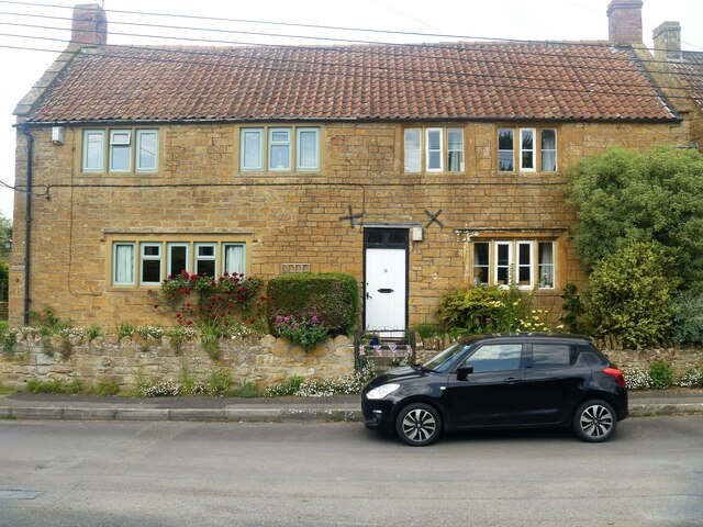
Image: © Michael Dibb Taken: 19 May 2023
Numbers 9 and 11 Farm Street are two 18th century cottages, extended in the 19th century and altered in the 20th century. Constructed of squared Ham stone with ashlar dressings under a pantile roof. Listed, grade II, with details at: https://historicengland.org.uk/listing/the-list/list-entry/1235111 Tintinhull is a village in Somerset, some 4¼ miles northwest of Yeovil and about 17¼ miles southeast of Taunton. Originally an agricultural village with the surrounding landscape containing evidence of 2,000 years of farming, however, most working residents now commute. Mentioned in the Domesday Book, the village is home to the 17th century Tintinhull House and Gardens.
Images are licensed for reuse under creativecommons.org/licenses/by-sa/2.0
Image Location
Latitude
50.975239
Longitude
-2.712283