Pivot benchmark in London Street, Leek
Introduction
The photograph on this page of Pivot benchmark in London Street, Leek by John S Turner as part of the Geograph project.
The Geograph project started in 2005 with the aim of publishing, organising and preserving representative images for every square kilometre of Great Britain, Ireland and the Isle of Man.

There are currently over 7.5m images from over 14,400 individuals and you can help contribute to the project by visiting https://www.geograph.org.uk
Pivot benchmark in London Street, Leek
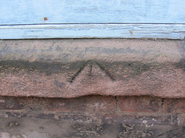
Image: © John S Turner Taken: 13 Mar 2012
An old Ordnance Survey benchmark on a warehouse in London Street, opposite house #27. The mark is recorded on the 1840-1890s OS map levelled at 638.4 feet above Liverpool Datum. For a wider view see Image Benchmark database: https://www.bench-marks.org.uk/bm196365
Images are licensed for reuse under creativecommons.org/licenses/by-sa/2.0
Image Location
Latitude
53.103713
Longitude
-2.023544