Eastern abutment of the old Laira road bridge
Introduction
The photograph on this page of Eastern abutment of the old Laira road bridge by Alan Murray-Rust as part of the Geograph project.
The Geograph project started in 2005 with the aim of publishing, organising and preserving representative images for every square kilometre of Great Britain, Ireland and the Isle of Man.

There are currently over 7.5m images from over 14,400 individuals and you can help contribute to the project by visiting https://www.geograph.org.uk
Eastern abutment of the old Laira road bridge
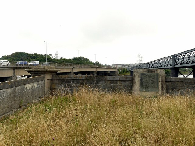
Image: © Alan Murray-Rust Taken: 28 Jun 2023
The bridge was a 5-arch iron bridge designed by J M Rendel, opened in 1827. It was replaced by the present bridge (in picture, left) in 1962. The plaque is in Latin and English and probably dates from the original building.
Images are licensed for reuse under creativecommons.org/licenses/by-sa/2.0
Image Location
Latitude
50.368675
Longitude
-4.107611