Houses on Bradford Street, Bocking
Introduction
The photograph on this page of Houses on Bradford Street, Bocking by Robin Webster as part of the Geograph project.
The Geograph project started in 2005 with the aim of publishing, organising and preserving representative images for every square kilometre of Great Britain, Ireland and the Isle of Man.

There are currently over 7.5m images from over 14,400 individuals and you can help contribute to the project by visiting https://www.geograph.org.uk
Houses on Bradford Street, Bocking
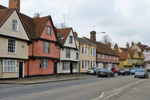
Image: © Robin Webster Taken: 19 Mar 2013
At the near end, 77, 79 and 81 (cream, red, white) are grade II*(star) listed, 16th century. Formerly the Woolpack Inn. Next, 83 is grade II listed, early 19th century. The red jettied building, 85 and 85a, is early 16th century but much altered, grade II listed. 87, the yellow gabled building, is grade II*(star) listed, 17th century.
Images are licensed for reuse under creativecommons.org/licenses/by-sa/2.0
Image Location
Latitude
51.887129
Longitude
0.556147