Former recreational area near All Saints in Wolverhampton
Introduction
The photograph on this page of Former recreational area near All Saints in Wolverhampton by Roger Kidd as part of the Geograph project.
The Geograph project started in 2005 with the aim of publishing, organising and preserving representative images for every square kilometre of Great Britain, Ireland and the Isle of Man.

There are currently over 7.5m images from over 14,400 individuals and you can help contribute to the project by visiting https://www.geograph.org.uk
Former recreational area near All Saints in Wolverhampton
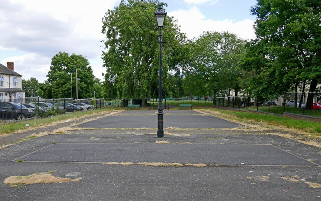
Image: © Roger Kidd Taken: 26 Jun 2023
This dilapidated space is between the terraced housing rows of Adelaide Walk and Gower Street, and is directly linked to All Saints Park. Larger scale maps describe it as a "Sports Facility". In 2012 it appeared to be functioning as a simple but neatly maintained playground area, see Image
Images are licensed for reuse under creativecommons.org/licenses/by-sa/2.0
Image Location
Latitude
52.578495
Longitude
-2.118161