A6 and the Rose and Crown, Low Hesket
Introduction
The photograph on this page of A6 and the Rose and Crown, Low Hesket by Jo and Steve Turner as part of the Geograph project.
The Geograph project started in 2005 with the aim of publishing, organising and preserving representative images for every square kilometre of Great Britain, Ireland and the Isle of Man.

There are currently over 7.5m images from over 14,400 individuals and you can help contribute to the project by visiting https://www.geograph.org.uk
A6 and the Rose and Crown, Low Hesket
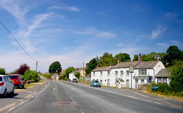
Image: © Jo and Steve Turner Taken: 9 Jun 2023
The Rose and Crown is a mid 18th century pub which was "nationalised" by the State Management Scheme on 25 August 1916 and The Carlisle Kid tells us it sold back into private ownership in 1973 for £8,750 with his photo https://www.geograph.org.uk/photo/5382136. In 2006 planning approved the erection of single storey side/rear extension to form dining room. CAMRA described this pub as "One of the few roadside inns to survive the M6 taking traffic away", unfortunately this appears to be no longer the case. A search of my directories produced; 1828 John Crackhall; 1829 only Carrier's Cart and Horse & Jockey listed; 1847 only Queens Head and Horse & Jockey listed; 1858 John Beaumont; 1894-1897 Isaac Armstrong (stone mason by 1901); 1901 Thomas Henderson; 1906 William Howe; 1910-1914 Mrs Esther Pattinson.
Images are licensed for reuse under creativecommons.org/licenses/by-sa/2.0
Image Location
Latitude
54.809773
Longitude
-2.833925