Old Wayside Cross by the B3415 in Fowey
Introduction
The photograph on this page of Old Wayside Cross by the B3415 in Fowey by P Barnett as part of the Geograph project.
The Geograph project started in 2005 with the aim of publishing, organising and preserving representative images for every square kilometre of Great Britain, Ireland and the Isle of Man.

There are currently over 7.5m images from over 14,400 individuals and you can help contribute to the project by visiting https://www.geograph.org.uk
Old Wayside Cross by the B3415 in Fowey
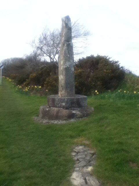
Image: © P Barnett Taken: 11 Mar 2016
The Castle Dore Stone or the Tristan Stone. The old shaft, base and steps of a Wayside Cross. Originally situated near the Iron Age hill fort of Castle Dore at SX103548, it has been moved to the northeast side of the B3415, 370 metres southeast of the junction with the A3082. Fowey parish. Grade II* Listed https://historicengland.org.uk/listing/the-list/list-entry/1219027 and a Scheduled Monument https://historicengland.org.uk/listing/the-list/list-entry/1016287. See also http://www.geograph.org.uk/photo/800074 and http://www.geograph.org.uk/photo/4244666. Milestone Society National ID: CWRE_FOW
Images are licensed for reuse under creativecommons.org/licenses/by-sa/2.0
Image Location
Latitude
50.338662
Longitude
-4.654129