Lodge Road
Introduction
The photograph on this page of Lodge Road by Ian Capper as part of the Geograph project.
The Geograph project started in 2005 with the aim of publishing, organising and preserving representative images for every square kilometre of Great Britain, Ireland and the Isle of Man.

There are currently over 7.5m images from over 14,400 individuals and you can help contribute to the project by visiting https://www.geograph.org.uk
Lodge Road
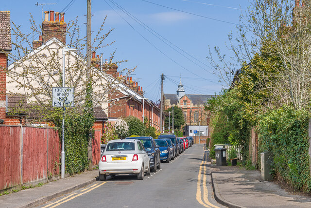
Image: © Ian Capper Taken: 20 Apr 2023
Looking along Lodge Road, with late 19th Century terraced housing on the left. The houses are first marked on the 1896 25 inch map, although the line of the road is shown on earlier maps. In the background is Tonbridge College Chapel - see Image
Images are licensed for reuse under creativecommons.org/licenses/by-sa/2.0
Image Location
Latitude
51.19905
Longitude
0.272566