The Selby Canal
Introduction
The photograph on this page of The Selby Canal by Paul Glazzard as part of the Geograph project.
The Geograph project started in 2005 with the aim of publishing, organising and preserving representative images for every square kilometre of Great Britain, Ireland and the Isle of Man.

There are currently over 7.5m images from over 14,400 individuals and you can help contribute to the project by visiting https://www.geograph.org.uk
The Selby Canal
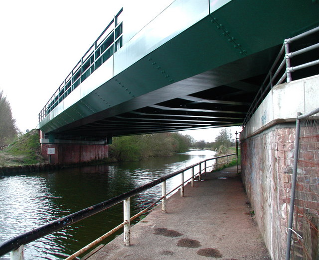
Image: © Paul Glazzard Taken: 5 Apr 2008
The Selby to Doncaster railway line crossing the Selby Canal, where the towpath forms part of the Trans Pennine Trail. The canal was built in the 1770s by the Aire and Calder Canal Company, worried by rumours of a planned canal between Leeds and Selby which could have taken some of their business. It was dug in a hurry and as a result was only three and a half feet deep. The Trans Pennine Trail runs for 215 miles from Hornsea to Southport and was officially opened in September 2001.
Images are licensed for reuse under creativecommons.org/licenses/by-sa/2.0
Image Location
Latitude
53.770755
Longitude
-1.071579