Barrington houses [15]
Introduction
The photograph on this page of Barrington houses [15] by Michael Dibb as part of the Geograph project.
The Geograph project started in 2005 with the aim of publishing, organising and preserving representative images for every square kilometre of Great Britain, Ireland and the Isle of Man.

There are currently over 7.5m images from over 14,400 individuals and you can help contribute to the project by visiting https://www.geograph.org.uk
Barrington houses [15]
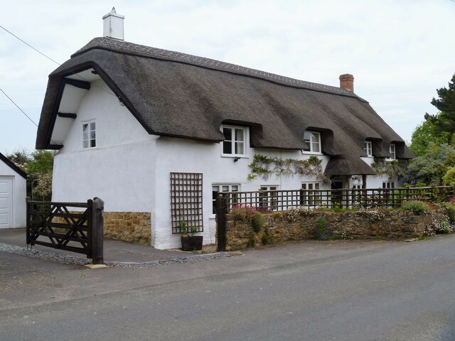
Image: © Michael Dibb Taken: 19 May 2023
Allenbury is a 15th century open hall house, later having a floor inserted. The house has been modernized and altered in the 19th and 20th centuries. Constructed of rubble stone and cob, rendered, all under a thatch roof. Some original internal features remain, including a jointed cruck truss. Listed, grade II, with details at: https://historicengland.org.uk/listing/the-list/list-entry/1264677 The village of Barrington in Somerset, lies some 10¼ miles west of Yeovil and about 11 miles southeast of Taunton, on the southern edge of the Somerset Levels. The village is home to Barrington Court, an estate of some 80 acres with a Tudor manor house. Barrington was originally an agricultural village but most working residents now commute.
Images are licensed for reuse under creativecommons.org/licenses/by-sa/2.0
Image Location
Latitude
50.960371
Longitude
-2.871973