Furnace Pond
Introduction
The photograph on this page of Furnace Pond by Anthony Stevenson as part of the Geograph project.
The Geograph project started in 2005 with the aim of publishing, organising and preserving representative images for every square kilometre of Great Britain, Ireland and the Isle of Man.

There are currently over 7.5m images from over 14,400 individuals and you can help contribute to the project by visiting https://www.geograph.org.uk
Furnace Pond
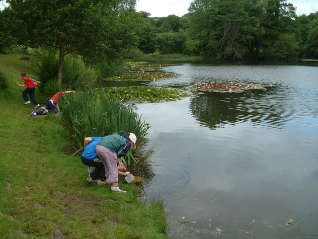
Image: © Anthony Stevenson Taken: 10 Jul 2007
A Year 5 class from Penygaer Primary School on a science fieldtrip (studying a freshwater ecosystem) to Furnace Pond. The pond, once a reservoir for the town of Llanelli is now a favourite venue for walkers and fishermen (and budding scientists!), and is a haven for wildlife.
Images are licensed for reuse under creativecommons.org/licenses/by-sa/2.0
Image Location
Latitude
51.698285
Longitude
-4.16594