Muirtown Basin, Inverness + dredger Fairway
Introduction
The photograph on this page of Muirtown Basin, Inverness + dredger Fairway by Chris Allen as part of the Geograph project.
The Geograph project started in 2005 with the aim of publishing, organising and preserving representative images for every square kilometre of Great Britain, Ireland and the Isle of Man.

There are currently over 7.5m images from over 14,400 individuals and you can help contribute to the project by visiting https://www.geograph.org.uk
Muirtown Basin, Inverness + dredger Fairway
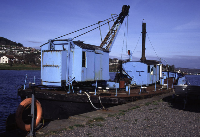
Image: © Chris Allen Taken: 13 Apr 1995
Dumb steam grab dredger Fairway. Used on the Caledonian Canal. Priestman crane. Now scrapped. I hope I've got the location right. It was beside the British Waterways Board Office.
Images are licensed for reuse under creativecommons.org/licenses/by-sa/2.0
Image Location
Latitude
57.484368
Longitude
-4.246791