Old Roadsign, Haw Lane, Olveston
Introduction
The photograph on this page of Old Roadsign, Haw Lane, Olveston by Mr Red as part of the Geograph project.
The Geograph project started in 2005 with the aim of publishing, organising and preserving representative images for every square kilometre of Great Britain, Ireland and the Isle of Man.

There are currently over 7.5m images from over 14,400 individuals and you can help contribute to the project by visiting https://www.geograph.org.uk
Old Roadsign, Haw Lane, Olveston
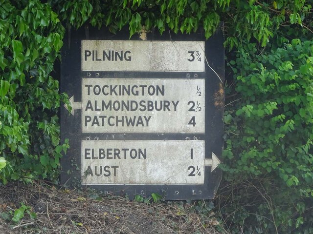
Image: © Mr Red Taken: 22 May 2023
Direction sign on the Southern side of the road. Aust was significant as a ferry route to Wales Inscription: Pilning 3¾ // Tockington ½ / Almondsbury 2½ / Patchway 4 // Elberton 1 / Aust 2¼ Milestone Society National ID: tbc
Images are licensed for reuse under creativecommons.org/licenses/by-sa/2.0
Image Location
Latitude
51.579613
Longitude
-2.575042