Ablington houses [1]
Introduction
The photograph on this page of Ablington houses [1] by Michael Dibb as part of the Geograph project.
The Geograph project started in 2005 with the aim of publishing, organising and preserving representative images for every square kilometre of Great Britain, Ireland and the Isle of Man.

There are currently over 7.5m images from over 14,400 individuals and you can help contribute to the project by visiting https://www.geograph.org.uk
Ablington houses [1]
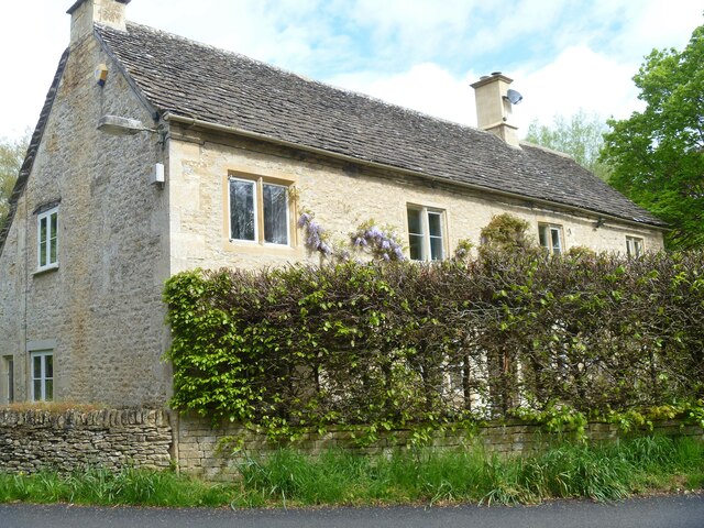
Image: © Michael Dibb Taken: 10 May 2023
Bridge House was formerly two houses, now one. Built in the mid or late 18th century with 20th century rear alterations. Constructed of limestone rubble stone with ashlar chimneys under a stone slate roof. Listed, grade II, with details at: https://historicengland.org.uk/listing/the-list/list-entry/1341831 The hamlet of Ablington is located in Gloucestershire astride the River Coln some 6¼ miles northeast of Cirencester and about 1 mile upstream from Bibury. The name 'Ablington' is derived from the 'estate called after Eadbald' (personal name Ēadbald + ing + tūn) and has been recorded as Eadbaldingtun, Ablinton and Ablyngton.
Images are licensed for reuse under creativecommons.org/licenses/by-sa/2.0
Image Location
Latitude
51.767203
Longitude
-1.853521