Queen's Head, Front Street, Cullercoats
Introduction
The photograph on this page of Queen's Head, Front Street, Cullercoats by Geoff Holland as part of the Geograph project.
The Geograph project started in 2005 with the aim of publishing, organising and preserving representative images for every square kilometre of Great Britain, Ireland and the Isle of Man.

There are currently over 7.5m images from over 14,400 individuals and you can help contribute to the project by visiting https://www.geograph.org.uk
Queen's Head, Front Street, Cullercoats
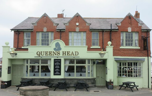
Image: © Geoff Holland Taken: 30 May 2023
When the first edition of the Ordnance Survey Six-Inch map of the area was published in 1865 there were four public houses in the small village of Cullercoats: Queen's Head, Newcastle Arms and two Ship Inns. It is common in historic villages for there to be a few buildings that appear more important than the others due to their size or location. In Cullercoats there are several buildings with prominence including the Queens Head, the Watch House and the RNLI Lifeboat House. The Queen's Head has recently undergone a colourful exterior makeover.
Images are licensed for reuse under creativecommons.org/licenses/by-sa/2.0
Image Location
Latitude
55.036692
Longitude
-1.432155