Old Boundary Marker on Johnny Ball Lane, Bristol
Introduction
The photograph on this page of Old Boundary Marker on Johnny Ball Lane, Bristol by Roadside Relics as part of the Geograph project.
The Geograph project started in 2005 with the aim of publishing, organising and preserving representative images for every square kilometre of Great Britain, Ireland and the Isle of Man.

There are currently over 7.5m images from over 14,400 individuals and you can help contribute to the project by visiting https://www.geograph.org.uk
Old Boundary Marker on Johnny Ball Lane, Bristol
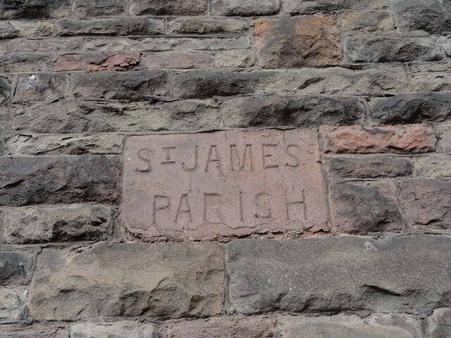
Image: © Roadside Relics Taken: 19 Aug 2021
Parish Boundary Marker set in an arch in a retaining wall on the west side of Johnny Ball Lane, an alley between Upper Maudlin Street and Narrow Lewins Mead, Bristol. See also http://www.geograph.org.uk/photo/4853131 and http://www.geograph.org.uk/photo/4853147. Milestone Society National ID: GL_BSSJ01pb
Images are licensed for reuse under creativecommons.org/licenses/by-sa/2.0
Image Location
Latitude
51.457158
Longitude
-2.59653