Steep Slope separating the Links and the Northern Promenade, Whitley Bay
Introduction
The photograph on this page of Steep Slope separating the Links and the Northern Promenade, Whitley Bay by Geoff Holland as part of the Geograph project.
The Geograph project started in 2005 with the aim of publishing, organising and preserving representative images for every square kilometre of Great Britain, Ireland and the Isle of Man.

There are currently over 7.5m images from over 14,400 individuals and you can help contribute to the project by visiting https://www.geograph.org.uk
Steep Slope separating the Links and the Northern Promenade, Whitley Bay
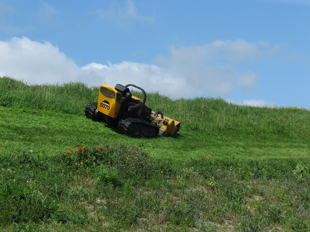
Image: © Geoff Holland Taken: 23 May 2023
The grass on this slope was in the process of being cut by this remote controlled machine when I wandered past. The machine is a Robocut which is designed for tackling tough terrain and features a low centre of gravity making it an outstanding all-terrain mowing machine capable of mastering slopes up to 55 degrees while protecting the operator from any danger. The bottom half of the slope is a wildflower strip stretching for many hundreds of metres (see https://www.geograph.org.uk/photo/7273045) along the edge of the promenade.
Images are licensed for reuse under creativecommons.org/licenses/by-sa/2.0
Image Location


Leaflet Map data © OpenStreetMap
Latitude
55.055116
Longitude
-1.452245