Old milestone
Introduction
The photograph on this page of Old milestone by Chris Minto as part of the Geograph project.
The Geograph project started in 2005 with the aim of publishing, organising and preserving representative images for every square kilometre of Great Britain, Ireland and the Isle of Man.

There are currently over 7.5m images from over 14,400 individuals and you can help contribute to the project by visiting https://www.geograph.org.uk
Old milestone
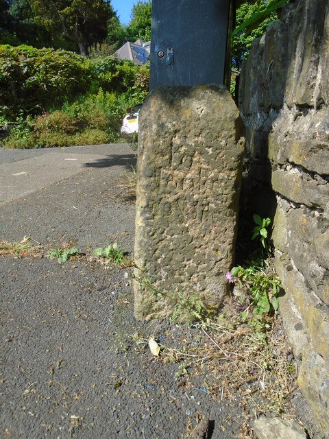
Image: © Chris Minto Taken: 21 May 2023
This shows the rhs of the milestone/stoop on Mill Bank Road. To/Honley/2½ Miles. Towards the end of the 17C , Justices of the Peace ordered that milestones/guidestones should be set up. In most cases this didn't happen until the first quarter of the 18C. In the north of England they are called stoops which is Scandanavian for stone. This stone is mentioned in 'Huddersfield Highways Down the Ages' by WB Crump, published in 1949.
Images are licensed for reuse under creativecommons.org/licenses/by-sa/2.0
Image Location
Latitude
53.588463
Longitude
-1.845119