View near Beggar's Bush
Introduction
The photograph on this page of View near Beggar's Bush by Derek Harper as part of the Geograph project.
The Geograph project started in 2005 with the aim of publishing, organising and preserving representative images for every square kilometre of Great Britain, Ireland and the Isle of Man.

There are currently over 7.5m images from over 14,400 individuals and you can help contribute to the project by visiting https://www.geograph.org.uk
View near Beggar's Bush
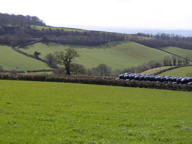
Image: © Derek Harper Taken: 30 Mar 2008
Looking towards Dunscombe from the lane shown in Image The black bales are stacked in between parallel hedges on what used to be the main road between Exeter and Newton Abbot. For many years it was then the northbound carriageway of the A380. Since the completion of the new road which can be seen in the background across the valley, it has been disused and blocked off. Beyond, the land drops into Dunscombe. To the left of the prominent oak, a lane climbs from Higher Dunscombe Farm. The trees on the left horizon above the main road are on Ideford Common.
Images are licensed for reuse under creativecommons.org/licenses/by-sa/2.0
Image Location
Latitude
50.602887
Longitude
-3.565644