Pike House, Trow Green
Introduction
The photograph on this page of Pike House, Trow Green by Mr Red as part of the Geograph project.
The Geograph project started in 2005 with the aim of publishing, organising and preserving representative images for every square kilometre of Great Britain, Ireland and the Isle of Man.

There are currently over 7.5m images from over 14,400 individuals and you can help contribute to the project by visiting https://www.geograph.org.uk
Pike House, Trow Green
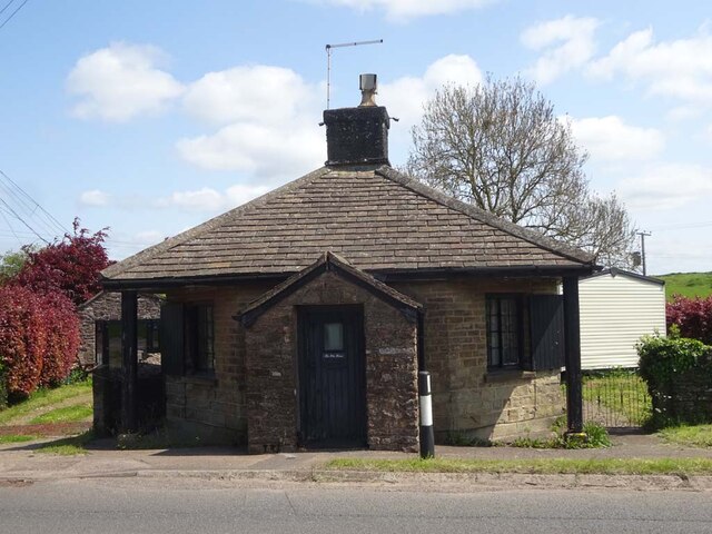
Image: © Mr Red Taken: 16 May 2023
A former Toll House on the B4228 South of Coleford, and 1km South of Image It served the Forest of Dean Turnpike Trust and dates from the early 19ᵗʰ c. Grade II listed Nᴼ. 1186347 see https://historicengland.org.uk/listing/the-list/list-entry/1186347 Milestone Society National ID: GL.NEW
Images are licensed for reuse under creativecommons.org/licenses/by-sa/2.0
Image Location
Latitude
51.758776
Longitude
-2.612117