Beeches Avenue
Introduction
The photograph on this page of Beeches Avenue by Ian Capper as part of the Geograph project.
The Geograph project started in 2005 with the aim of publishing, organising and preserving representative images for every square kilometre of Great Britain, Ireland and the Isle of Man.

There are currently over 7.5m images from over 14,400 individuals and you can help contribute to the project by visiting https://www.geograph.org.uk
Beeches Avenue
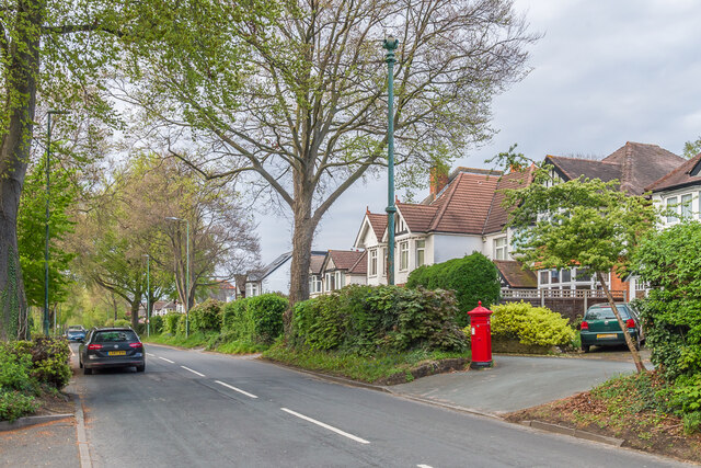
Image: © Ian Capper Taken: 26 Apr 2023
Looking along Beeches Avenue, a road marked (with no houses) on both the 1871 6 inch map and 1896 25 inch map as Beechnut Tree Road, on the 1913 map (by now largely developed) as The Beeches, and then on the 1935 edition as The Beeches Avenue, with the "The" being retained on subsequent maps up to at least the 1967 1:10,000 map. In the centre of the photo is the sewer vent column in Image and below it is the Penfold pillar box in Image
Images are licensed for reuse under creativecommons.org/licenses/by-sa/2.0
Image Location
Latitude
51.354607
Longitude
-0.171173