Stroudwater canal terminus at Pike lock near Eastington
Introduction
The photograph on this page of Stroudwater canal terminus at Pike lock near Eastington by Roger Davies as part of the Geograph project.
The Geograph project started in 2005 with the aim of publishing, organising and preserving representative images for every square kilometre of Great Britain, Ireland and the Isle of Man.

There are currently over 7.5m images from over 14,400 individuals and you can help contribute to the project by visiting https://www.geograph.org.uk
Stroudwater canal terminus at Pike lock near Eastington
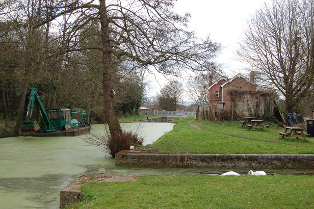
Image: © Roger Davies Taken: 18 Mar 2008
View looks westwards towards Pike bridge just beyond the disused lock. The former lock-keeper's cottage is on the right. Currently this is the most westerly point navigable on the restored Stroudwater canal.
Images are licensed for reuse under creativecommons.org/licenses/by-sa/2.0
Image Location
Latitude
51.752633
Longitude
-2.313728