29 and 31 High Street, Auchtermuchty
Introduction
The photograph on this page of 29 and 31 High Street, Auchtermuchty by Bill Harrison as part of the Geograph project.
The Geograph project started in 2005 with the aim of publishing, organising and preserving representative images for every square kilometre of Great Britain, Ireland and the Isle of Man.

There are currently over 7.5m images from over 14,400 individuals and you can help contribute to the project by visiting https://www.geograph.org.uk
29 and 31 High Street, Auchtermuchty
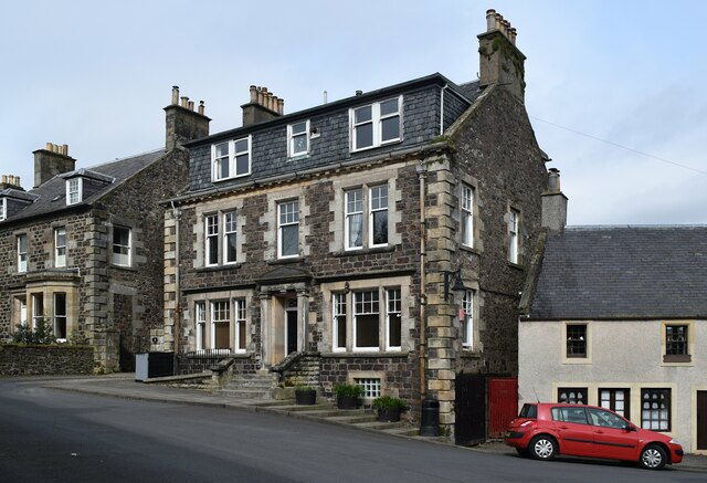
Image: © Bill Harrison Taken: 16 Apr 2023
The imposing early 19th Century house is not listed, but the C-listing for the house to the left notes that it was once the 'burgh offices' with interesting windows. At a later stage it has been disfigured by a modern full-width dormer.
Images are licensed for reuse under creativecommons.org/licenses/by-sa/2.0
Image Location
Latitude
56.292131
Longitude
-3.233326