Old farmstead at East Law
Introduction
The photograph on this page of Old farmstead at East Law by Robert Graham as part of the Geograph project.
The Geograph project started in 2005 with the aim of publishing, organising and preserving representative images for every square kilometre of Great Britain, Ireland and the Isle of Man.

There are currently over 7.5m images from over 14,400 individuals and you can help contribute to the project by visiting https://www.geograph.org.uk
Old farmstead at East Law
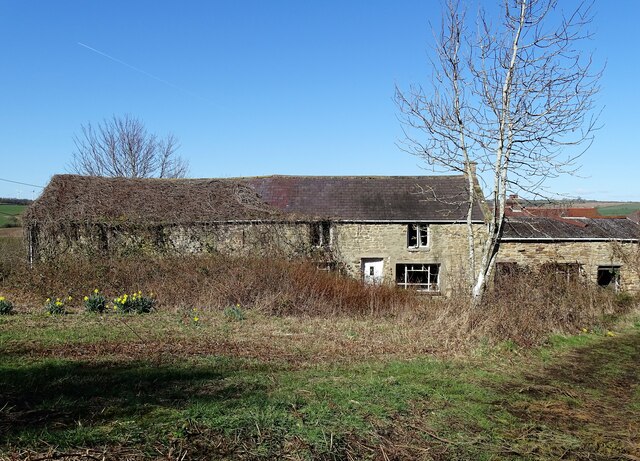
Image: © Robert Graham Taken: 27 Mar 2023
This old farmhouse dates back to the early 19th century probably. It's shown on the First Series Ordnance Survey map of 1862. It is a linear type farmstead with a farmhouse and then a byre for the animals attached to it. Obviously it has been altered over the years, but it retains the basic original layout. Doesn't seem to be occupied at present.
Images are licensed for reuse under creativecommons.org/licenses/by-sa/2.0
Image Location
Latitude
54.884434
Longitude
-1.846121