Raasay Iron Mine kiln bases
Introduction
The photograph on this page of Raasay Iron Mine kiln bases by John Allan as part of the Geograph project.
The Geograph project started in 2005 with the aim of publishing, organising and preserving representative images for every square kilometre of Great Britain, Ireland and the Isle of Man.

There are currently over 7.5m images from over 14,400 individuals and you can help contribute to the project by visiting https://www.geograph.org.uk
Raasay Iron Mine kiln bases
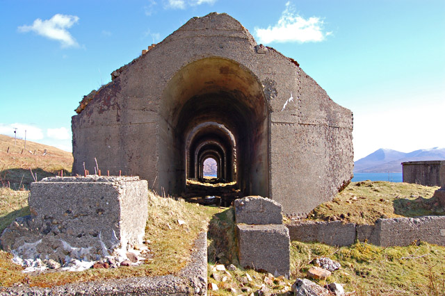
Image: © John Allan Taken: 31 Mar 2008
The brick and concrete bases are all that remain of the five tall calcination kilns that stood here when the mine was active. The Raasay iron mines and associated railways were active between 1912 and 1942.
Images are licensed for reuse under creativecommons.org/licenses/by-sa/2.0
Image Location


Leaflet Map data © OpenStreetMap
Latitude
57.335396
Longitude
-6.059731