The start of a route with public access just east of Laleston
Introduction
The photograph on this page of The start of a route with public access just east of Laleston by eswales as part of the Geograph project.
The Geograph project started in 2005 with the aim of publishing, organising and preserving representative images for every square kilometre of Great Britain, Ireland and the Isle of Man.

There are currently over 7.5m images from over 14,400 individuals and you can help contribute to the project by visiting https://www.geograph.org.uk
The start of a route with public access just east of Laleston
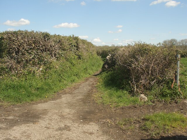
Image: © eswales Taken: 25 Apr 2023
An Ordnance Survey map marked ‘other route with public access’ seen at its southern end, a junction with a lane (Ffordd y Gyfraith). No signage for this route is to be seen at the junction. The route is narrow for a good part of its length, with the appearance of a (hard-surfaced) footpath, but broadens towards its northern end, where it looks more like a country track. A local website (laleston.com @ https://www.laleston.com/laleston-stones-trail ) describes the whole route as an ‘ancient cart track’. It is approximately 500 metres long and runs to a spot on Llangewydd Road a few hundred metres west of Bryntirion in Bridgend.
Images are licensed for reuse under creativecommons.org/licenses/by-sa/2.0
Image Location
Latitude
51.508946
Longitude
-3.616543