
Teetering on the brink
Introduction
The photograph on this page of Teetering on the brink by Ian Dodds as part of the Geograph project.
The Geograph project started in 2005 with the aim of publishing, organising and preserving representative images for every square kilometre of Great Britain, Ireland and the Isle of Man.

There are currently over 7.5m images from over 14,400 individuals and you can help contribute to the project by visiting https://www.geograph.org.uk
Teetering on the brink
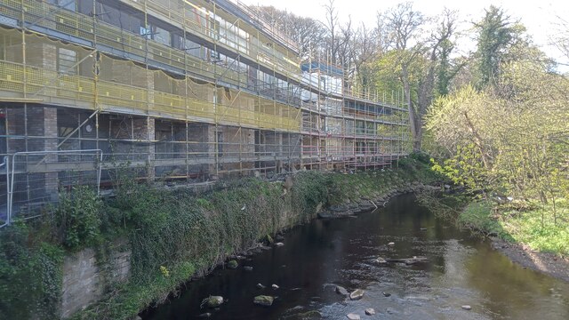
Image: © Ian Dodds Taken: 25 Apr 2023
These flats are already named on OpenStreetMap as 'Water of Leith Apartments', despite being some way short of completion. This may have something to do with their construction having fallen behind schedule. Remedial works have recently been carried out to shore up the bank, so to speak, after the record-breaking floods of 30th December 2022, which at this spot ripped away some gabions (those wire-mesh cubes full of big stones) from the bank the block is built upon. The Water of Leith Conservation Trust, amongst other organisations, appealed against the building of this building. Edinburgh Council agreed and refused planning permission, but as is often the way of things these days, the Scottish Government overruled the council. The fact that the development is so small that the usual 'affordable properties' are not even included as a convenient (forgive my cynicism!) get-out clause makes this decision fairly unusual. The far end of the bank still looks extremely precarious to me.
Images are licensed for reuse under creativecommons.org/licenses/by-sa/2.0
Image Location

Latitude
55.922959
Longitude
-3.247818