Inverallochy
Introduction
The photograph on this page of Inverallochy by Anne Burgess as part of the Geograph project.
The Geograph project started in 2005 with the aim of publishing, organising and preserving representative images for every square kilometre of Great Britain, Ireland and the Isle of Man.

There are currently over 7.5m images from over 14,400 individuals and you can help contribute to the project by visiting https://www.geograph.org.uk
Inverallochy
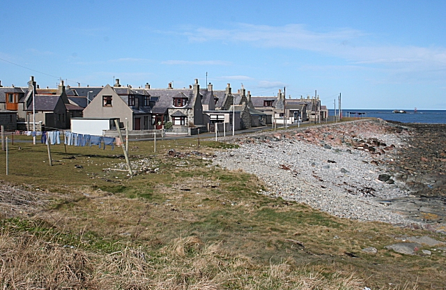
Image: © Anne Burgess Taken: 29 Mar 2008
The houses of Inverallochy, like those elsewhere on the North Sea coast, were traditionally built with their gables to the sea, so that the smallest area of wall was exposed to severe weather. Originally they would probably not have had windows in the seaward gable, though most have had a window added. The nearest house is more recent.
Images are licensed for reuse under creativecommons.org/licenses/by-sa/2.0
Image Location
Latitude
57.677003
Longitude
-1.928728