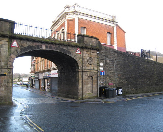
Shipquay Gate, Walls of Derry
Introduction
The photograph on this page of Shipquay Gate, Walls of Derry by Rossographer as part of the Geograph project.
The Geograph project started in 2005 with the aim of publishing, organising and preserving representative images for every square kilometre of Great Britain, Ireland and the Isle of Man.
There are currently over 7.5m images from over 14,400 individuals and you can help contribute to the project by visiting https://www.geograph.org.uk

Image: © Rossographer Taken: 28 Mar 2008
Shipquay Gate on the Walls of Derry at the bottom of Shipquay Street. Derry remains the only completely walled city in Ireland and is one of the finest examples of a Walled City in Europe. The Walls were built during the period 1613-1618 as defences for early seventeenth century settlers from England and Scotland who came to Derry during the Ulster Plantations. The Walls are approximately 1.5km in circumference and vary in width between 12 and 35 feet. They form a walkway around the inner city and provide a unique promenade to view the layout of the original town. The four original gates to the Walled City are Bishop’s Gate, Ferryquay Gate, Butcher Gate and Shipquay Gate. Three further gates were added - magazine Gate, Castle Gate and New Gate.

