Burstwick Drain, Hedon
Introduction
The photograph on this page of Burstwick Drain, Hedon by Paul Glazzard as part of the Geograph project.
The Geograph project started in 2005 with the aim of publishing, organising and preserving representative images for every square kilometre of Great Britain, Ireland and the Isle of Man.

There are currently over 7.5m images from over 14,400 individuals and you can help contribute to the project by visiting https://www.geograph.org.uk
Burstwick Drain, Hedon
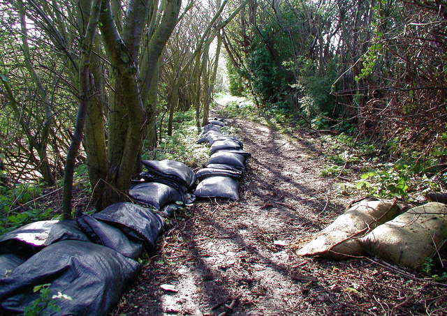
Image: © Paul Glazzard Taken: 31 Mar 2008
Sandbags on the public footpath north of Burstwick Drain, a reminder of the floods in June last year. It's now the end of March and the water level in the drain is normal: about three metres below the top of the bank at this point.
Images are licensed for reuse under creativecommons.org/licenses/by-sa/2.0
Image Location
Latitude
53.736431
Longitude
-0.191031