Bridgnorth Bypass Bridge across the River Severn
Introduction
The photograph on this page of Bridgnorth Bypass Bridge across the River Severn by Roger Kidd as part of the Geograph project.
The Geograph project started in 2005 with the aim of publishing, organising and preserving representative images for every square kilometre of Great Britain, Ireland and the Isle of Man.

There are currently over 7.5m images from over 14,400 individuals and you can help contribute to the project by visiting https://www.geograph.org.uk
Bridgnorth Bypass Bridge across the River Severn
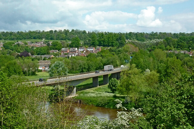
Image: © Roger Kidd Taken: 14 May 2014
Viewed by looking north-east from a passing Severn Valley Railway train. The A458 (from Shrewsbury) leads to Stourbridge, and via the A454 to Wolverhampton. The bypass was opened in 1985. The river flows from left to right. The housing on the left is part of Bridgnorth Low Town.
Images are licensed for reuse under creativecommons.org/licenses/by-sa/2.0
Image Location
Latitude
52.52748
Longitude
-2.415772