Demolition of John Ruskin School, Shirley, Croydon
Introduction
The photograph on this page of Demolition of John Ruskin School, Shirley, Croydon by Dr Neil Clifton as part of the Geograph project.
The Geograph project started in 2005 with the aim of publishing, organising and preserving representative images for every square kilometre of Great Britain, Ireland and the Isle of Man.

There are currently over 7.5m images from over 14,400 individuals and you can help contribute to the project by visiting https://www.geograph.org.uk
Demolition of John Ruskin School, Shirley, Croydon
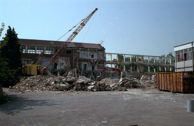
Image: © Dr Neil Clifton Taken: 21 May 1992
The school was demolished to make way for high-quality housing. The much older windmill nearby was retained as a 'feature'. One of the new roads was laughably named 'Post Mill Close', although the windmill was not a post mill at all.
Images are licensed for reuse under creativecommons.org/licenses/by-sa/2.0
Image Location
Latitude
51.370168
Longitude
-0.055803