Princes Risborough: Church Street
Introduction
The photograph on this page of Princes Risborough: Church Street by Nigel Cox as part of the Geograph project.
The Geograph project started in 2005 with the aim of publishing, organising and preserving representative images for every square kilometre of Great Britain, Ireland and the Isle of Man.

There are currently over 7.5m images from over 14,400 individuals and you can help contribute to the project by visiting https://www.geograph.org.uk
Princes Risborough: Church Street
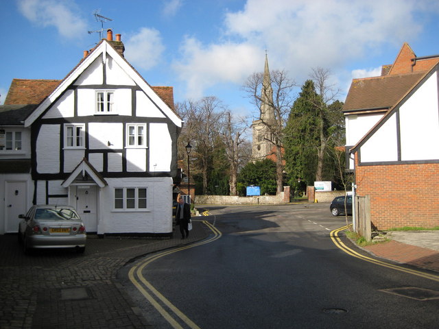
Image: © Nigel Cox Taken: 30 Mar 2008
The half-timbered Tudor building called Vine House is on the left while the church is beyond the trees. This is a pinch point in the street and there is a 1955 Francis Frith photograph here http://www.francisfrith.com/search/england/buckinghamshire/princes+risborough/photos/princes+risborough_P282005.htm taken from slightly further back towards the Market Square, which shows Vine House with what could be the vine growing up against the gable end.
Images are licensed for reuse under creativecommons.org/licenses/by-sa/2.0
Image Location
Latitude
51.723539
Longitude
-0.834528