Old Boundary Marker on the wall of 34 St Nicholas Street Bristol
Introduction
The photograph on this page of Old Boundary Marker on the wall of 34 St Nicholas Street Bristol by Roadside Relics as part of the Geograph project.
The Geograph project started in 2005 with the aim of publishing, organising and preserving representative images for every square kilometre of Great Britain, Ireland and the Isle of Man.

There are currently over 7.5m images from over 14,400 individuals and you can help contribute to the project by visiting https://www.geograph.org.uk
Old Boundary Marker on the wall of 34 St Nicholas Street Bristol
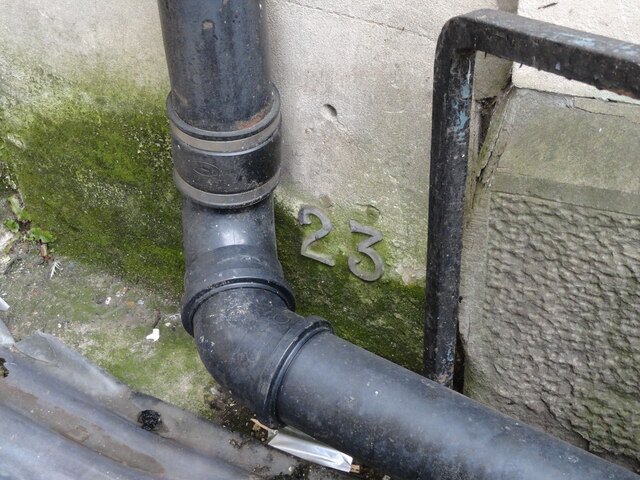
Image: © Roadside Relics Taken: 11 Oct 2022
Parish Boundary Marker at ground level beside a drainpipe and above a grill to the basement area on the southwest facing frontage of No.34 St Nicholas Street, Bristol, the former Stock Exchange, now a restaurant. Inscribed SL / 23 to mark the boundary of St Leonard parish, abolished in 1896 to help create Central Bristol parish, which was abolished in turn in 1898 to help create Bristol parish. Only the numeral remains. Milestone Society National ID: GL_BSSL23pb
Images are licensed for reuse under creativecommons.org/licenses/by-sa/2.0
Image Location
Latitude
51.453787
Longitude
-2.594543