A tunnel between two parts of Pill
Introduction
The photograph on this page of A tunnel between two parts of Pill by Neil Owen as part of the Geograph project.
The Geograph project started in 2005 with the aim of publishing, organising and preserving representative images for every square kilometre of Great Britain, Ireland and the Isle of Man.

There are currently over 7.5m images from over 14,400 individuals and you can help contribute to the project by visiting https://www.geograph.org.uk
A tunnel between two parts of Pill
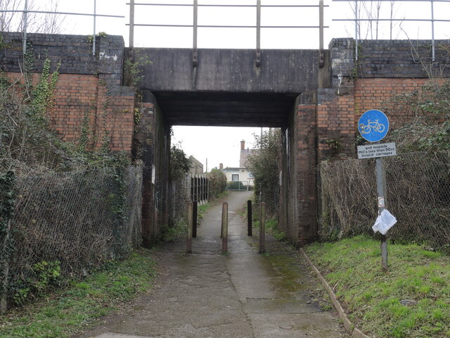
Image: © Neil Owen Taken: 22 Mar 2023
The old Bristol and Portishead railway came along in the nineteenth century, when this area was fields. A footpath was respected by the construction of this bridge, which now connects two modern housing developments. A sign restricts passage, but specifically allows low-powered motorbikes and invalid carriages.
Images are licensed for reuse under creativecommons.org/licenses/by-sa/2.0
Image Location
Latitude
51.483164
Longitude
-2.691196