Bulpit Lane Level Crossing
Introduction
The photograph on this page of Bulpit Lane Level Crossing by Stephen McKay as part of the Geograph project.
The Geograph project started in 2005 with the aim of publishing, organising and preserving representative images for every square kilometre of Great Britain, Ireland and the Isle of Man.

There are currently over 7.5m images from over 14,400 individuals and you can help contribute to the project by visiting https://www.geograph.org.uk
Bulpit Lane Level Crossing
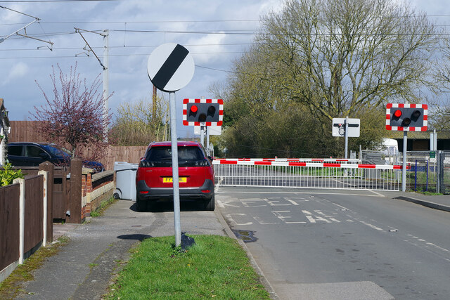
Image: © Stephen McKay Taken: 24 Mar 2023
The East Coast Main Line, running predominantly through flat countryside, is peppered with level crossings and there are several in the Newark area alone (the West Coast Main Line, by contrast, has very few and none at all south of Preston). They are an operational headache for Network Rail and, with modern day service frequencies, a cause of much delay and frustration for road users. Unfortunately, replacing them with bridges is not always practical as here on the edge of Balderton where there are houses very close to the railway. In this view the barriers have lowered and the red lights are flashing and, with two trains due to pass, it would be several minutes before the road would reopen. Curiously, the name of the road is Bulpit Road but the crossing is called Bulpit Lane; it is on the edge of Balderton.
Images are licensed for reuse under creativecommons.org/licenses/by-sa/2.0
Image Location
Latitude
53.060823
Longitude
-0.774591