Utility marker on Fore Street
Introduction
The photograph on this page of Utility marker on Fore Street by Neil Owen as part of the Geograph project.
The Geograph project started in 2005 with the aim of publishing, organising and preserving representative images for every square kilometre of Great Britain, Ireland and the Isle of Man.

There are currently over 7.5m images from over 14,400 individuals and you can help contribute to the project by visiting https://www.geograph.org.uk
Utility marker on Fore Street
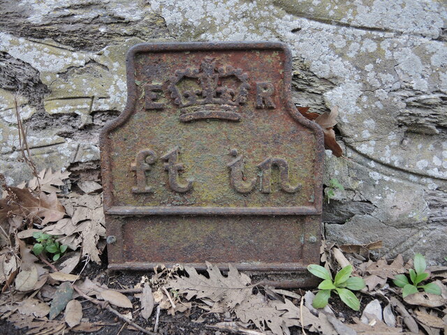
Image: © Neil Owen Taken: 23 Feb 2023
A cast iron marker (presumably for telephonic systems) remains in the ground by houses. Its use is now long disregarded but forms part of the local history. See Image] for a location view.
Images are licensed for reuse under creativecommons.org/licenses/by-sa/2.0
Image Location
Latitude
51.092065
Longitude
-3.016629