Smallwood Primary School and Language Unit - north wing
Introduction
The photograph on this page of Smallwood Primary School and Language Unit - north wing by Robin Webster as part of the Geograph project.
The Geograph project started in 2005 with the aim of publishing, organising and preserving representative images for every square kilometre of Great Britain, Ireland and the Isle of Man.

There are currently over 7.5m images from over 14,400 individuals and you can help contribute to the project by visiting https://www.geograph.org.uk
Smallwood Primary School and Language Unit - north wing
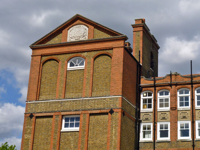
Image: © Robin Webster Taken: 12 May 2012
Showing the date of enlargement on the pediment, 1908, and the date of the part towards the centre - 1898. It is not clear if the actual centre part was also 1898 - it looks a more obvious stand-alone block with towers at each end. For the whole frontage, see Image The school is grade II listed, but the listing apparently relies on these inscriptions for its dating.
Images are licensed for reuse under creativecommons.org/licenses/by-sa/2.0
Image Location
Latitude
51.430882
Longitude
-0.179824