The Manor House
Introduction
The photograph on this page of The Manor House by Ian Capper as part of the Geograph project.
The Geograph project started in 2005 with the aim of publishing, organising and preserving representative images for every square kilometre of Great Britain, Ireland and the Isle of Man.

There are currently over 7.5m images from over 14,400 individuals and you can help contribute to the project by visiting https://www.geograph.org.uk
The Manor House
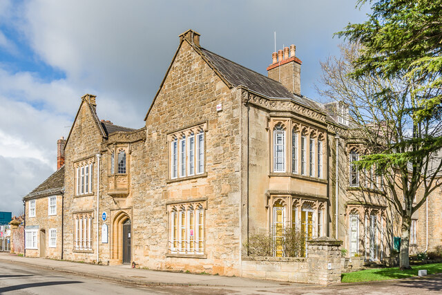
Image: © Ian Capper Taken: 18 Mar 2023
Building thought to date from c.1500. The oriel above the door is original, but was originally on the east side, moved to its current position in c.1820 as part of a "wild sub-gothicization" as described in the Dorset "Buildings of England" volume. The building now houses Sherborne Town Council. Grade II listed - see https://historicengland.org.uk/listing/the-list/list-entry/1110696?section=official-list-entry. Beyond in 41 Newland, also grade II listed - see https://historicengland.org.uk/listing/the-list/list-entry/1110695?section=official-list-entry.
Images are licensed for reuse under creativecommons.org/licenses/by-sa/2.0
Image Location
Latitude
50.950256
Longitude
-2.514238