Durham House
Introduction
The photograph on this page of Durham House by David Martin as part of the Geograph project.
The Geograph project started in 2005 with the aim of publishing, organising and preserving representative images for every square kilometre of Great Britain, Ireland and the Isle of Man.

There are currently over 7.5m images from over 14,400 individuals and you can help contribute to the project by visiting https://www.geograph.org.uk
Durham House
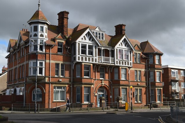
Image: © David Martin Taken: 18 Mar 2023
On historic Ordnance Survey maps, this imposing building overlooking the road junction is shown as a hotel - it is currently divided into apartments.
Images are licensed for reuse under creativecommons.org/licenses/by-sa/2.0
Image Location
Latitude
51.36805
Longitude
1.133049