The Tink-a-Tank, Warwick
Introduction
The photograph on this page of The Tink-a-Tank, Warwick by Robin Stott as part of the Geograph project.
The Geograph project started in 2005 with the aim of publishing, organising and preserving representative images for every square kilometre of Great Britain, Ireland and the Isle of Man.

There are currently over 7.5m images from over 14,400 individuals and you can help contribute to the project by visiting https://www.geograph.org.uk
The Tink-a-Tank, Warwick
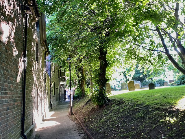
Image: © Robin Stott Taken: 25 Jun 2022
The Tink-a-Tank is a footpath between The Butts and Church Street by the War Memorial. The name imitates the sound of hard heels on the path. To the north (right) is St Mary's churchyard.
Images are licensed for reuse under creativecommons.org/licenses/by-sa/2.0
Image Location
Latitude
52.281794
Longitude
-1.587909