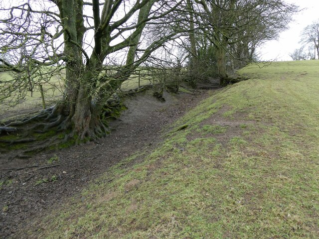
Field boundary at Rhiwlas, most likely an old sunken way
Introduction
The photograph on this page of Field boundary at Rhiwlas, most likely an old sunken way by Jeremy Bolwell as part of the Geograph project.
The Geograph project started in 2005 with the aim of publishing, organising and preserving representative images for every square kilometre of Great Britain, Ireland and the Isle of Man.
There are currently over 7.5m images from over 14,400 individuals and you can help contribute to the project by visiting https://www.geograph.org.uk

Image: © Jeremy Bolwell Taken: 16 Mar 2023
Now, and for some considerable time, a field boundary, but originally an ancient path or droveway, linking two settlements, or part of a longer route, or just a local drove way onto the local high ground. I am always interested to spot and explore these. Some are quite probably prehistoric, being established literally millennia ago by local herdsmen, shepherds, farmers, drovers, hunters and travellers. Worn down by hard little hooves, water, constant use and remaining as a very vocal message from our past, overlooked, underexplored and little appreciated. But they have outlasted nearly everything else.

