Old Bridge Marker on the A680 Whalley Road
Introduction
The photograph on this page of Old Bridge Marker on the A680 Whalley Road by D Phillips as part of the Geograph project.
The Geograph project started in 2005 with the aim of publishing, organising and preserving representative images for every square kilometre of Great Britain, Ireland and the Isle of Man.

There are currently over 7.5m images from over 14,400 individuals and you can help contribute to the project by visiting https://www.geograph.org.uk
Old Bridge Marker on the A680 Whalley Road
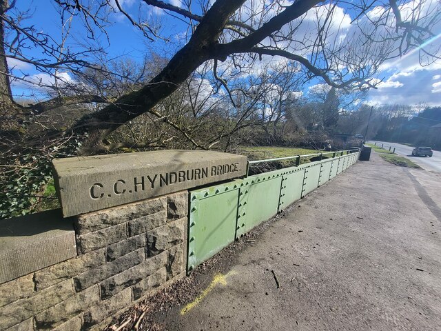
Image: © D Phillips Taken: 1 Mar 2023
Bridge Marker inscribed in the capstone of the north pier of Hyndburn Bridge, Hyndburn Brook, on the east side of the A680 Whalley Road. On the boundary of Great Harwood and Clayton le Moors parishes until 1974 when both were abolished. REBUILT 1930 in inscribed on the capstone of the south pier on the east side of the road. Milestone Society National ID: LA_GHACLM01br
Images are licensed for reuse under creativecommons.org/licenses/by-sa/2.0
Image Location


Leaflet Map data © OpenStreetMap
Latitude
53.786557
Longitude
-2.384216