Tracks, West Hampstead ThamesLink station
Introduction
The photograph on this page of Tracks, West Hampstead ThamesLink station by Robin Stott as part of the Geograph project.
The Geograph project started in 2005 with the aim of publishing, organising and preserving representative images for every square kilometre of Great Britain, Ireland and the Isle of Man.

There are currently over 7.5m images from over 14,400 individuals and you can help contribute to the project by visiting https://www.geograph.org.uk
Tracks, West Hampstead ThamesLink station
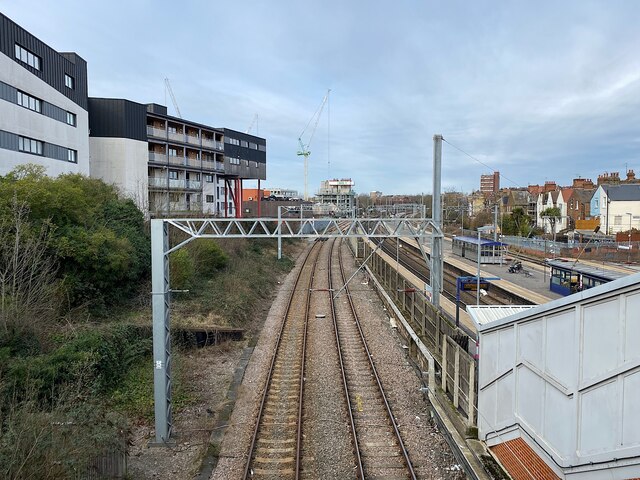
Image: © Robin Stott Taken: 11 Mar 2023
The tracks in the foreground carry through services from St Pancras to the east of England. Tracks through the platforms, right, are for ThamesLInk through services between Bedford, St Pancras and a swathe of the southeast. It is the northernmost of the three West Hampstead rail stations, the others being for London Overground services, and London Underground's Metropolitan and Jubilee Lines.
Images are licensed for reuse under creativecommons.org/licenses/by-sa/2.0
Image Location
Latitude
51.54827
Longitude
-0.193749