Toll House, A5, Hendre-isaf
Introduction
The photograph on this page of Toll House, A5, Hendre-isaf by David Elis-Williams as part of the Geograph project.
The Geograph project started in 2005 with the aim of publishing, organising and preserving representative images for every square kilometre of Great Britain, Ireland and the Isle of Man.

There are currently over 7.5m images from over 14,400 individuals and you can help contribute to the project by visiting https://www.geograph.org.uk
Toll House, A5, Hendre-isaf
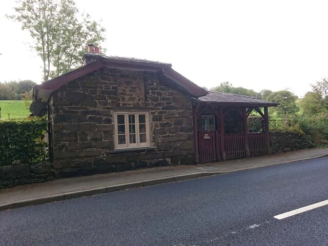
Image: © David Elis-Williams Taken: 10 Mar 2023
On the South side of the road, labelled Hendre-isaf Gate (Lower Hendre) in 1900 maps. It served the Shrewsbury to Holyhead Turnpike Trust. There is a reference near the bridge on the other side of the house called Hendre-isaf to an "Old Gate" over the River Conway with an earlier bridge, which was by-passed in Thomas Telford's improvements of 1815-1820. This house dates from then. Grade II Listed Building Cadwr Nᴼ. 18328 https://cadwpublic-api.azurewebsites.net/reports/listedbuilding/FullReport?lang=&id=18328 - British Listed Buildings - https://britishlistedbuildings.co.uk/300018328-tyr-peg-ysbyty-ifan#.ZAtKqB_P1PY Milestone Society National ID: CON.PTF01
Images are licensed for reuse under creativecommons.org/licenses/by-sa/2.0
Image Location
Latitude
53.046012
Longitude
-3.71416